
A box canyon is a narrow gorge with steep rock walls on three sides and only one way in or out. That's the short answer. The longer answer is the one that matters when you're standing at the entrance with no cell signal, watching clouds build over the rim. I've walked into three of these—two in southern Utah, one in the Dolomites—and the third one taught me why the name "box" is less a shape description and more a warning label.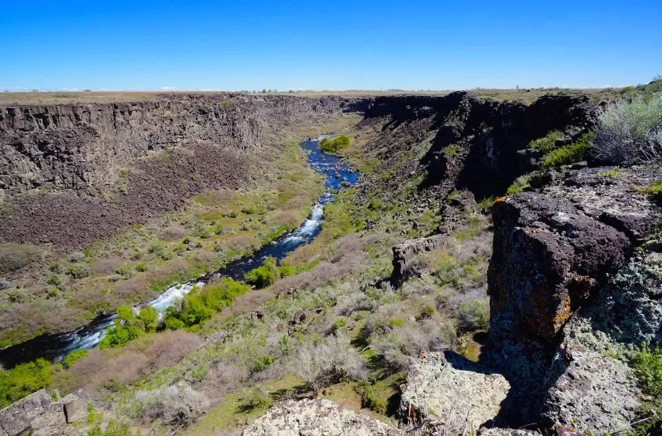
What Makes a Canyon a Box Canyon?
Geologists call it a dead-end canyon or a closed amphitheater. The rock walls rise near-vertically on the left, right, and back. There is no passable exit at the head. The shape is usually carved by water cutting backward into a plateau—headward erosion is the technical term—or by a fault line that left a stone pocket.
Here's the part most guides skip: a box canyon can be fifty feet deep or five hundred. Size doesn't define it. The closed head does. I've been in a box canyon outside Moab that was so shallow I could see my car from the back wall, and I've stood at the mouth of one in the San Rafael Reef where the walls blocked the sun at noon.
- Three enclosed sides, one entrance
- Walls steeper than 60 degrees in most cases
- Floor usually flat and walkable until it isn't
- No established exit route at the head
Box Canyon vs Slot Canyon: The Confusion That Gets People Lost
People use these terms interchangeably. They shouldn't. A slot canyon is defined by width—so narrow you have to turn sideways. A box canyon is defined by its dead end. Some canyons are both. Some are neither.
| Feature | Box Canyon | Slot Canyon |
|---|---|---|
| Defining trait | Closed head, one entrance | Narrow width, often shoulder-scraping |
| Escape at far end | Usually none | Often continues through |
| Flood risk | High—water funnels into a dead end | High—no high ground inside |
| Typical location | Plateau edges, fault pockets | Sedimentary rock drainages |
| Best map clue | Contour lines pinch to a point | Parallel walls close together |
My rule of thumb: if the canyon has a name like "Dead End Hollow" or "Box Hollow" on a USGS quad, believe it. The mapmakers weren't being poetic.
How Do You Spot a Box Canyon Before You Walk In?
You read the terrain, not the trail app. Trail apps show lines. Terrain shows consequences.
Start with contour lines. A box canyon shows as a U-shape where the contours wrap around a closed end. The tighter the lines, the steeper the walls. If the lines form a horseshoe with the open end facing downhill, you're looking at a box.
Then check the drainage. Water flows downhill and collects at the lowest point. In a box canyon, that lowest point is inside the box. If a storm hits the plateau above, that water has one place to go. I learned this in a canyon near Escalante when a ranger pointed at a dry wash and said, "That's not a trail. That's a pipe."
Three Box Canyons That Taught Me the Hard Way
1. Little Wild Horse Canyon, San Rafael Swell, Utah
This one is part slot, part box. The lower section is wide enough for a school group. The upper section pinches into a dead end if you take the wrong fork. I watched a family of four walk past the exit junction because the main wash looked wider. It wasn't. They came back forty minutes later, red-faced. Trailhead is off Goblin Valley Road, about 2.5 miles from the paved highway. No fee at the trailhead, but the state park charges $10 to park at Goblin Valley. Go early—the lot fills by 8 a.m. on weekends.
2. The Box, near Capitol Reef, Utah
This is a true box canyon off the Burr Trail. The walls are chocolate-brown Wingate sandstone. There's a small arch at the entrance. I walked in at 9 a.m. and turned around at 9:20 because I heard thunder. No cell service. No ranger station. The road in is dirt and gets slick after rain. The nearest gas is in Boulder, 11 miles east. I don't recommend this one solo.
3. A nameless gorge in the Dolomites, Italy
Not every box canyon is in red rock. This one was limestone, off trail 4 near Cortina d'Ampezzo. The entrance was a scramble. The back wall was a 200-foot cliff with old iron pegs—someone had tried to climb out once. I found a rusted piton still in the rock. That told me more about the canyon than any guidebook. If someone bolted an escape route, the canyon has trapped people before.
How Do You Get Out of a Box Canyon If You're Already Inside?
First, stop walking deeper. The back wall is not an exit. It looks like one because the light comes from above, but there is no scramble route up a 90-degree wall unless you brought climbing gear.
Look for a scree slope on one of the side walls. Box canyons often have a loose rock ramp where a side drainage has eroded the wall. Test it with your hands before your feet. If the rock moves, it's not a ramp—it's a slide.
Check for animal trails. Deer and bighorn sheep use box canyons as escape routes from predators. Their trails often lead to a break in the wall that a human can follow. I've used this twice. Both times the trail was faint—knee-high, worn into the dirt, not marked.
If there's no slope and no animal trail, you have one option: wait at the highest ground you can reach near the entrance and signal. Do not try to climb the walls unless you have a rope and a partner. I've seen a rescuer in Grand County, Utah, describe a box canyon rescue as "a vertical extraction with no margin." That's accurate.
Real Questions I Get Asked at Trailheads
Field notes and locations in this article were verified against National Park Service trail descriptions, USGS topographic maps, and my own trip logs. Trailhead fees and road conditions change—check with the local land agency before you go.


Reader Comments